
Smoke and Roadway Safety Guide from the National Wildfire Coordinating Group.https://www.nwcg.gov/publications/477 …
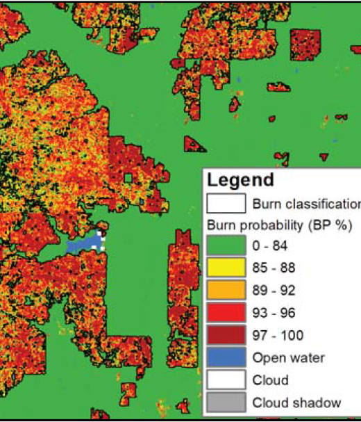
New Operational National Satellite Burned Area Product
New 1-pager from USGS, Great Plains Fire Science Exchange, and SRFSN: New Operational National Satellite Burned Area Product. Land …
Continue Reading about New Operational National Satellite Burned Area Product
Fire Operations Guidance in Bark Beetle Stands
Revised operational guide from R2 USFS about safe operations in bark beetle stands. Due to altered fuel conditions, personnel …
Continue Reading about Fire Operations Guidance in Bark Beetle Stands
Quantitative Wildfire Risk Assessment (QWRA)
A workflow and tools to perform a Quantitative Wildfire Risk Assessment (QWRA) from the project to the unit scale is now available …
Continue Reading about Quantitative Wildfire Risk Assessment (QWRA)
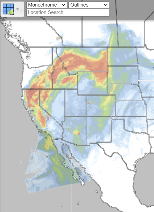
Real Earth Interface
RealEarth is a data discovery and visualization platform developed at SSEC/CIMSS at the University of Wisconsin-Madison.Web …
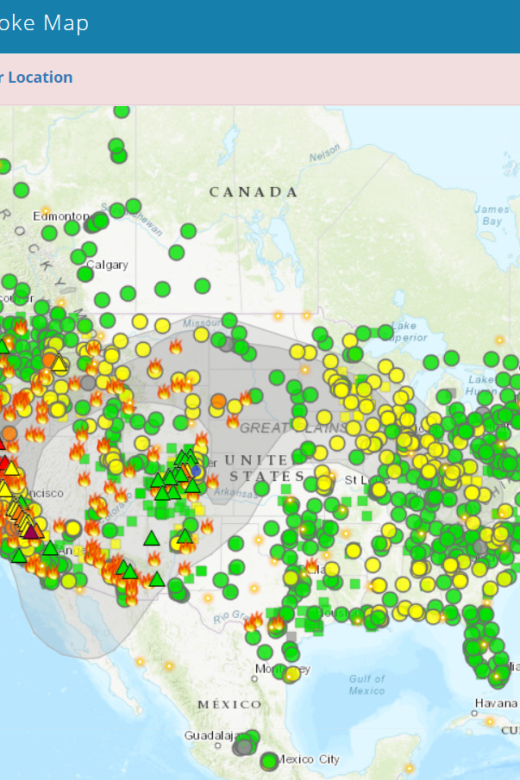
Fire and Smoke Map
The Fire and Smoke Map displays information on ground level air quality monitors recording fine particulates (PM2.5) from smoke …

Mapping Fuels for Regional Smoke Management and Emissions Inventories Final Report
View the full report hereAbstract: Fuels are highly variable and dynamic in space and time, and fuel loading can vary considerably …
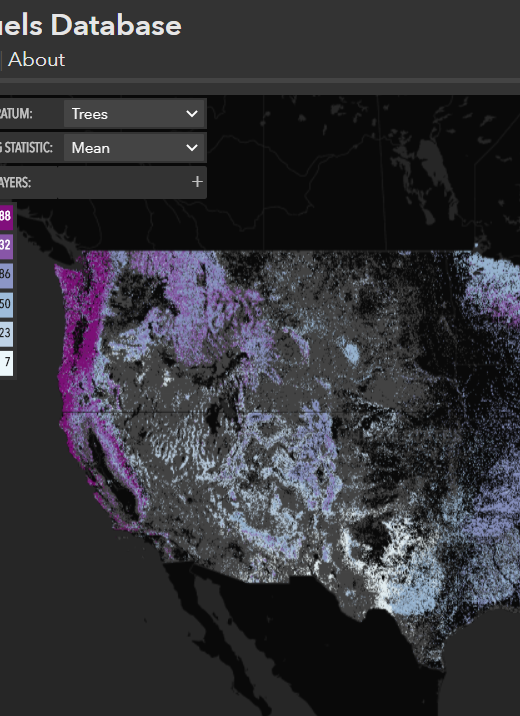
North American Wildland Fuels Database
NAWFD aggregates fuel loading information from 26,620 field sites compiled from 271 data sources. Each data point is assigned …
Continue Reading about North American Wildland Fuels Database