• Skip to primary navigation
  • Skip to main content
Southern Rockies Fire Science Network

Southern Rockies Fire Science Network

JFSP Fire Science Exchange Network

  • Home
  • About
    • About Us
    • Our Partners
  • Subregions
    • Why Subregions?
    • Black Hills / Pine Ridge
    • Canyonlands/Desert Montane
    • Northern New Mexico Plateau
    • Southern Rockies
    • Wasatch Plateaus/Uinta Mountains
    • Wyoming Sagebrush
  • Events
    • Event Summaries
  • Resources
    • Pre and Post-Fire Emergency Resources
    • Research & Publications
    • Maps, Models & Apps
    • COVID-19
  • Contact
  • Show Search
Hide Search

Canyonlands/Desert Montane

canyonlands desert montane subregion outline map
Click the map to explore the landscap assesment created by LANDFIRE and the Conservation Data Lab

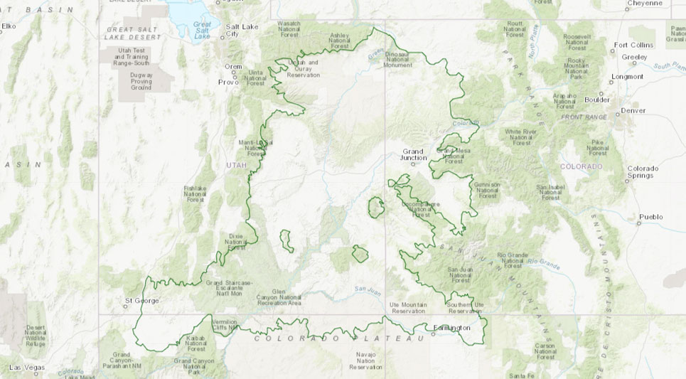
Patchy arid grasslands with xeric shrubs common in open stands with sagebrush dominant over extensive areas. Woodland zone is the most extensive, dominated by open stands of two-needle pinyon pine and juniper “pygmy forests”. Lodgepole pine and aspen are dominant in Utah.

HOT TOPICS:

  • Increasing tourism and intensity of recreational land use
  • Overcrowding of infrastructure in and around national parks and monuments
  • Invasive annual grasses
  • Pinyon-juniper invasion
  • Preservation of sagebrush habitat
  • Preservation of viewsheds
  • Heavy fuel loading
  • Livestock grazing

Subregion Representative Wanted! Contact our Program Coordinator Gloria Edwards for details:

Gloria Edwards
Southern Rockies Fire Science Network Coordinator
Colorado State University

gloria.edwards@colostate.edu

(970) 491-2991

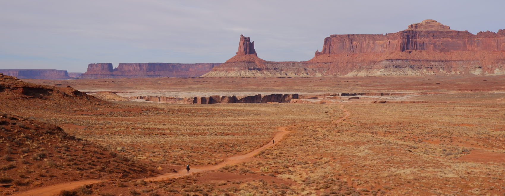
Photo Credit: Jonathan Terbush, @dubteebs on Instagram, Cinnamon Rim, 2019.

Footer

Connect With Us

  • Facebook
  • Twitter
  • YouTube

Sign up for our newsletter

Got a Question?
Email us.

This regional Fire Exchange is one of 15 regional fire science exchanges sponsored by the Joint Fire Science Program (JFSP).
View resources from multiple exchanges.