Subregions allow you to click your area in our map, or search using your subregion title, and be directed to resources relevant to your specific needs.
Clicking on the outlined subregion of the map will take you to its landscape assessment.
- The Southern Rockies Fire Science Network region includes 6 different ecotypes across seven different states.
- Each ecotype, or subregion, has significant fire management challenges specific to that area. Some of these unique challenges involve smoke management, invasive plants, endangered species, or WUI concerns.
- We created subregions to save time for website visitors like you who come here to find the latest fire science and information for your work as a fire manager, practitioner, or researcher.
These landscape assessments were created by LANDFIRE and the Conservation Data Lab.
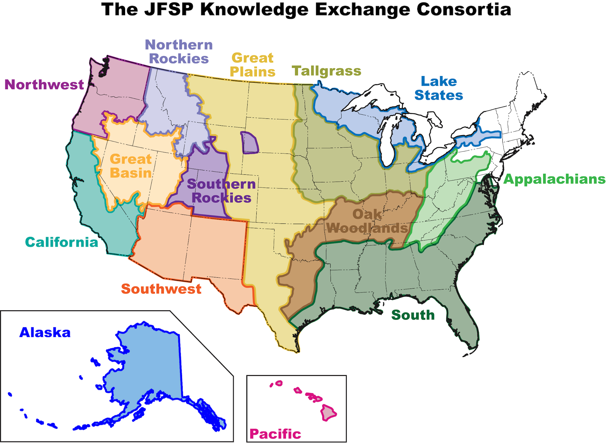
Why Are There Two Different Maps?

Although the JFSP has established regional fire science exchanges (FSEs) based on large ecologically similar regions, the Southern Rockies FSE includes a wide variety of unique desert, shrubland, and mountain habitats that represent vastly different topography, vegetation, and fuel types. With updated vegetation models available through LANDFIRE, SRFSN has added revised landscape subregions (above) to more accurately reflect the ecological provinces that encompass these vegetation types and provide users with estimates of prehistoric and current fuel types and metrics.
Questions or feedback?
Contact Program Coordinator Gloria Edwards gloria.edwards@colostate.edu 970-491-2991

