• Skip to primary navigation
  • Skip to main content
Southern Rockies Fire Science Network

Southern Rockies Fire Science Network

JFSP Fire Science Exchange Network

  • Home
  • About
    • About Us
    • Our Partners
  • Subregions
    • Why Subregions?
    • Black Hills
    • Wyoming Sagebrush
    • Uinta Basin
    • Wasatch Plateaus/Mountains
    • Rocky Mountains
    • Canyonlands/Desert Montane
  • Events
    • Event Summaries
  • Resources
    • Pre and Post-Fire Emergency Resources
    • Research & Publications
    • Maps, Models & Apps
    • COVID-19
  • Contact
  • Show Search
Hide Search

Fire and Smoke Map

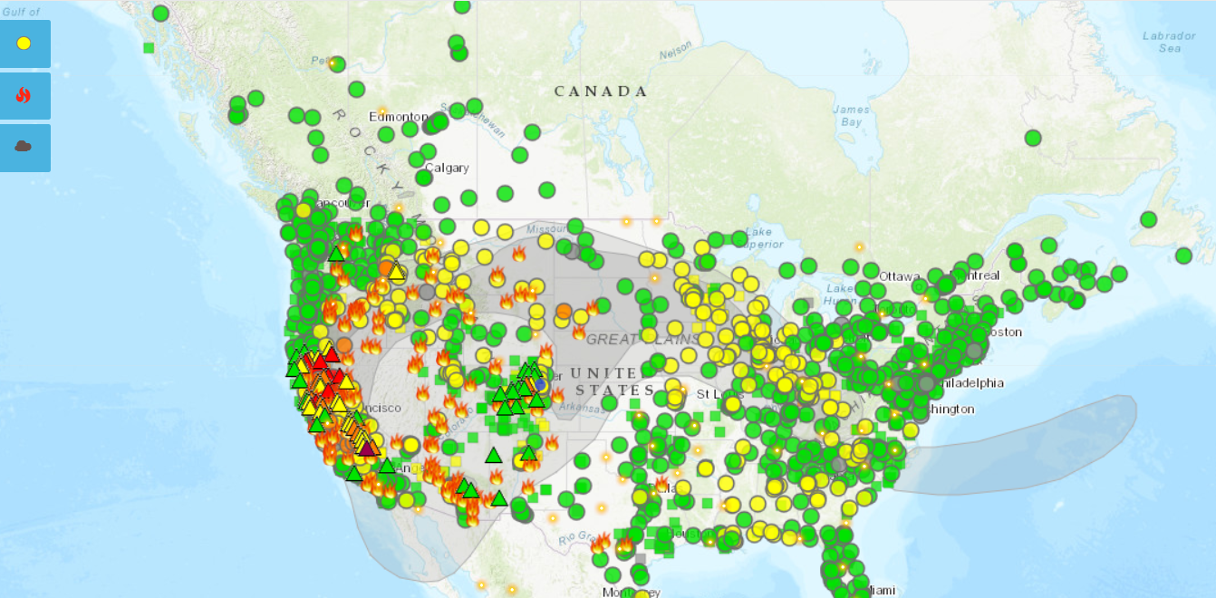
The Fire and Smoke Map displays information on ground level air quality monitors recording fine particulates (PM2.5) from smoke and other sources, as well as information on fires, smoke plume locations, and special statements about smoke issued by various sources.

This map is a collaborative effort between the U.S. Forest Service led Interagency Wildland Fire Air Quality Response Program (IWFAQRP) and the U.S. Environmental Protection Agency. Development work was done through an agreement with the University of Washington’s School of Environmental and Forest Sciences. This site relies on data provided from a number of sources.

View the interactive website here: https://fire.airnow.gov/

Posted by:
Gloria Edwards
Published on:
August 26, 2020

Categories: Maps, Models, and AppsTags: fire and fuels, fire data, fire technology, forest fire, fuel data, fuels, geospatial data, interactive tool, spatial fire planning, wildfire, Wildfire Operations & Management, Wildland Fire, wildland fire emissions, wildland fire smoke, Wildland Firefighting

Footer

Connect With Us

  • Facebook
  • Twitter
  • YouTube

Sign up for our newsletter

Got a Question?
Email us.

This regional Fire Exchange is one of 15 regional fire science exchanges sponsored by the Joint Fire Science Program (JFSP).
View resources from multiple exchanges.