• Skip to primary navigation
  • Skip to main content
Southern Rockies Fire Science Network

Southern Rockies Fire Science Network

JFSP Fire Science Exchange Network

  • Home
  • About
    • About Us
    • Our Partners
  • Subregions
    • Why Subregions?
    • Black Hills / Pine Ridge
    • Canyonlands/Desert Montane
    • Northern New Mexico Plateau
    • Southern Rockies
    • Wasatch Plateaus/Uinta Mountains
    • Wyoming Sagebrush
  • Events
    • Event Summaries
  • Resources
    • Pre and Post-Fire Emergency Resources
    • Research & Publications
    • Maps, Models & Apps
    • COVID-19
  • Contact
  • Show Search
Hide Search

Wyoming Sagebrush

Wyoming Sagebrush subregion outline map
Click the map to explore the landscap assesment created by LANDFIRE and the Conservation Data Lab

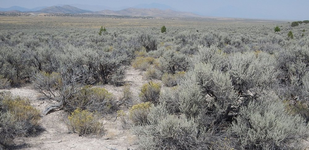
The Wyoming Basin shrub steppe, located within the desert and xeric shrublands biome, spans central and south-central Wyoming and extends into northwestern Colorado.

HOT TOPICS

  • Fire ecology and impacts on sagebrush
  • Invasive grasses and forbs
  • Domestic grazing, free-roaming horses
  • Sage-grouse ecology
  • Grazing in coniferous grasslands
  • Extractive industries and infrastructure

This subregion is sparsely populated and WUI concerns are minimal.

Partners

University of Wyoming Extension, Medicine Bow/Routt National Forests, Bureau of Land Management

Resources

USGS Wyoming Basin Ecoregion Assessment

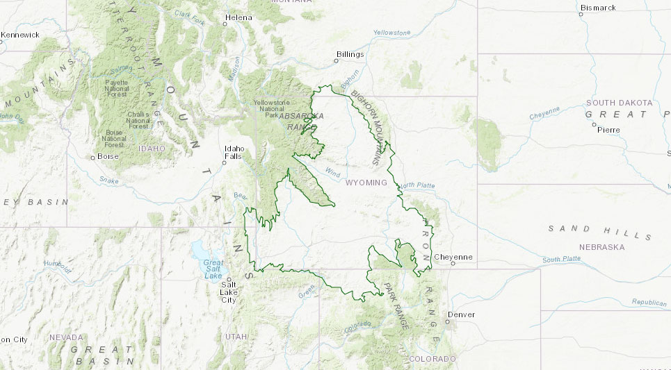
Map: Subregion National Forests and Grasslands

Subregion Representative

Dr. J. Derek Scasta, University of Wyoming Agricultural Sciences Extension

jscasta@uwyo.edu – 307-314-2615

Footer

Connect With Us

  • Facebook
  • Twitter
  • YouTube

Sign up for our newsletter

Got a Question?
Email us.

This regional Fire Exchange is one of 15 regional fire science exchanges sponsored by the Joint Fire Science Program (JFSP).
View resources from multiple exchanges.