Download the publication here.
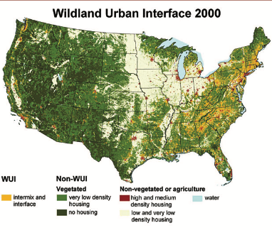
The purpose of this project is to provide information on “the area where houses and wildland vegetation coincide.” Although there are other ways of defining the wildland-urban interface (WUI), this is the definition referenced in the National Fire Plan. Details about the rationale, development, testing, and sensitivity analysis of this definition, as well as the data sources and analytical methods we used, can be found at the end of the article in the methods section.
The WUI maps and data were created with the hope they would be useful to planners and managers at the local, state, and national levels. Tools and information regarding the WUI are available on our Web site for public use. Users should note that the resulting WUI map does not indicate the risk of fire; it shows only where houses and wildland vegetation coincide. Some of the areas identified as WUI are prone to fire, and some are not.
Authors:
Susan I. Stewart, Northern Research Station, USDA Forest Service, Evanston, IL
Volker C. Radeloff, Department of Forestry, University of Wisconsin-Madison
Roger B. Hammer, Department of Sociology, Oregon State University

