• Skip to primary navigation
  • Skip to main content
Southern Rockies Fire Science Network

Southern Rockies Fire Science Network

JFSP Fire Science Exchange Network

  • Home
  • About
    • About Us
    • Our Partners
  • Subregions
    • Why Subregions?
    • Black Hills
    • Wyoming Sagebrush
    • Uinta Basin
    • Wasatch Plateaus/Mountains
    • Rocky Mountains
    • Canyonlands/Desert Montane
  • Events
    • Event Summaries
  • Resources
    • Pre and Post-Fire Emergency Resources
    • Research & Publications
    • Maps, Models & Apps
    • COVID-19
  • Contact
  • Show Search
Hide Search

From watersheds to the web: Online tools for modeling forest soil erosion

From the Rocky Mountain Research Station:

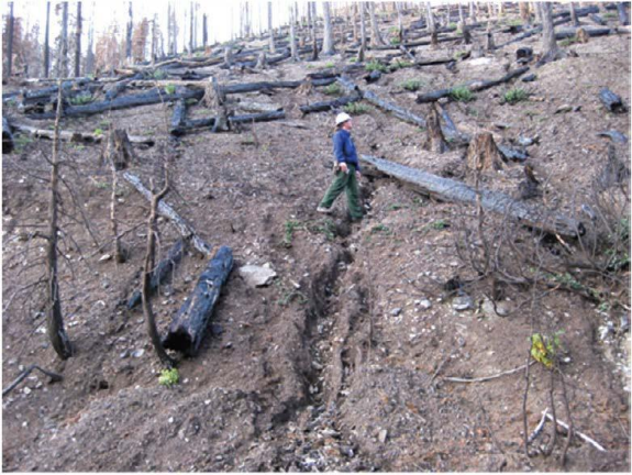
Forest erosion can lead to topsoil loss, and also to damaging deposits of sediment in aquatic ecosystems. For this reason, forest managers must be able to estimate the erosion potential of both planned management activities and catastrophic events, in order to decide where to use limited funds to focus erosion control efforts.

Read the brief here.

Read the original publication here.

Posted by:
Gloria Edwards
Published on:
April 9, 2020

Categories: Maps, Models, and Apps, Publication, Research Brief/SynthesisTags: disturbance, Forest Management, forest soils, forests, post-fire debris flows, post-fire erosion, post-fire runoff, post-fire treatments, Rocky Mountain Research Station, USFS

Footer

Connect With Us

  • Facebook
  • Twitter
  • YouTube

Sign up for our newsletter

Got a Question?
Email us.

This regional Fire Exchange is one of 15 regional fire science exchanges sponsored by the Joint Fire Science Program (JFSP).
View resources from multiple exchanges.