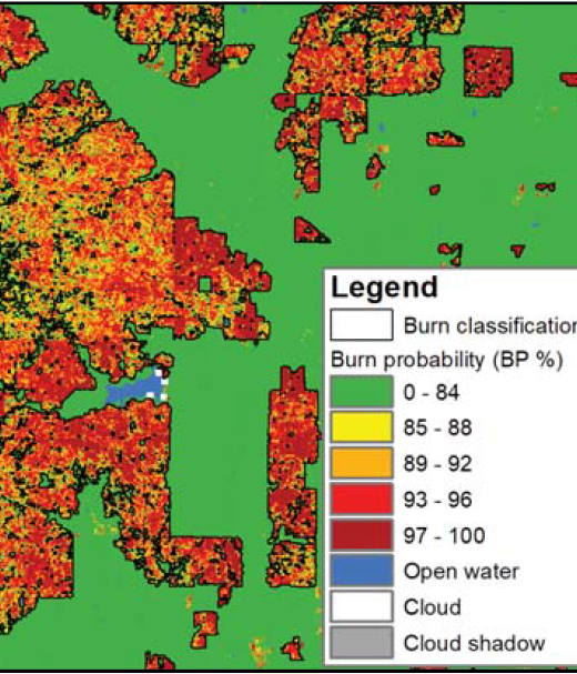
New 1-pager from USGS, Great Plains Fire Science Exchange, and SRFSN: New Operational National Satellite Burned Area Product. Land …
Continue Reading about New Operational National Satellite Burned Area Product

Southern Rockies Fire Science Network
JFSP Fire Science Exchange Network
New 1-pager from USGS, Great Plains Fire Science Exchange, and SRFSN: New Operational National Satellite Burned Area Product. Land …
Continue Reading about New Operational National Satellite Burned Area Product
Interactive real-time wildfire and forest fire map for Colorado. See current wildfires and wildfire perimeters in Colorado on the …
From Rezatec: “This webinar focuses on how remote technologies can inform and impact forest managers’ jobs. Information has …
Continue Reading about WEBINAR: Old Data – The Wildfire You Didn’t See Coming
Watch on YouTube. A team of five DRI researchers, along with nearly 35 other scientists, embarked on a unique kind of camping trip …
The Fire and Smoke Model Evaluation Experiment (FASMEE) is a multi-agency effort to provide advanced measurements necessary to …
Continue Reading about Fire and Smoke Model Evaluation Experiment (FASMEE) – video overview