• Skip to primary navigation
  • Skip to main content
Southern Rockies Fire Science Network

Southern Rockies Fire Science Network

JFSP Fire Science Exchange Network

  • Home
  • About
    • About Us
    • Our Partners
  • Subregions
    • Why Subregions?
    • Black Hills
    • Wyoming Sagebrush
    • Uinta Basin
    • Wasatch Plateaus/Mountains
    • Rocky Mountains
    • Canyonlands/Desert Montane
  • Events
    • Event Summaries
  • Resources
    • Pre and Post-Fire Emergency Resources
    • Research & Publications
    • Maps, Models & Apps
    • COVID-19
  • Contact
  • Show Search
Hide Search

Wildfires Know No Boundaries

From the Rocky Mountain Research Station:

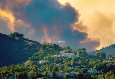
For the first time, U.S. Forest Service Rocky Mountain Research Station and Oregon State University scientists have assessed cross-boundary wildfire exposure in the western United States by mapping potential fire transmission among public and private lands, and identifying areas where ignitions are most likely to expose communities to wildfire.

Read the brief and full report here!

Posted by:
Gloria Edwards
Published on:
May 7, 2020

Categories: Publication, Research Brief/Synthesis, Technical ReportTags: Community Exposure, fire on private land, fuel loading, mapping, private lands, public land, Rocky Mountain Research Station, US Forest Service, wildfire risk assessment, wildfire simulations, wildland urban interface, WUI

Footer

Connect With Us

  • Facebook
  • Twitter
  • YouTube

Sign up for our newsletter

Got a Question?
Email us.

This regional Fire Exchange is one of 15 regional fire science exchanges sponsored by the Joint Fire Science Program (JFSP).
View resources from multiple exchanges.